Showing posts with label birds. Show all posts

Sunday, 11 March 2018

Day 4 at Barrington


Yesterday had been a full day but with sunshine and warm temperatures. The night had brought yet more rain with the murmuring of the river getting louder all the time. There is an odd cackle of kookaburra coming through the closed windows, with the day light attempting to lighten the gloom of the still dark clouds while I savoured my first cup of tea. It was going to be a gloomy rainy day after all? I was quite prepared to stay put as this is also the first time I am out on the day I take my chemo. Most chemo days I am kind of OK at least for the morning with some rumbling of the stomach issues. Going out today was a definite challenge and the mood was- let’s see how far I manage to stay up.

Barrington River Crossing

While having the porridge – by now Paul had mastered the ‘tucker fucker’ (I just heard this new slang for microwave and could not resist adding it here… it is funny, apt and colourful!) and so no porridge was wasted, we decided to go further up the coast as travelling longer on the highway would not take up a lot of time. So as per usual come half past nine cool bag with blood orange drink was packed; also I get pretty cold when I take Methotrexate and since it was already a cool morning I decided to add trousers and a long sleeves top and a warmer top into the bag – better be prepared than to get cold when the fever spikes; and off we went.


Low clouds over Bucketts Mountains

Thunderbolts Way from Barrington to Gloucester

By now the roads were familiar and getting to the highway was fairly quick with very little traffic on the smaller roads. From Nabiac we picked up the Pacific Highway and went north, past Possum Brush and Rainbow Flat, towards Taree. But this time we bypassed Taree and moved further up the coast passing Cundletown, Ghinni Ghinni and Jones Island. As we came up to Jones Island the heavens opened again and we feared this looked set for the day. There was not a break in the clouds but I had to have faith it would not last long. We considered the possibility that we might have to turn back as we have done a time or two when the rain did not allow us even to stop. But by the time we got to Coopernook after which we turn off on to scenic drive route to Harrington – Crowdy Head, the rain was gone and the sun back out.

This route took us to Harrington which is at the mouth of Manning River and on to the Crowdy Head that is at the headland. Harrington is a small seaside town which extends into the Harrington Beach State Park. Since it was early we decided to go up to the Crowdy Head first and look around before returning to Harrington in time for lunch. The road is through the rainforest, beautiful and peaceful. I did not realise that there was actually a small community in this place. The views from the road side are stunning and the Crowdy Bay appears never ending. There is a surfing club and of course the marina.

Crowdy Head Marina

The Lone Ranger?

We drove round the headland and the road round the few houses and saw that we could turn right and be back closing the loop. Now usually we have seen the map and got a good idea what was there but for some unknown reason we had failed to see there was a lighthouse there. Usually the lighthouses at headlands are unmissable but this one was just round the corner from where we turned off and with no signs for the lighthouse either we missed it all together. What a shame!

Crowdy Head Bay

Windy Crowdy Head 

Crowdy Head Bay

The way back along the Crowdy Head Road to Harrington took us to Beach Road where literally the beach starts. We decided to stop at the fish and chips shop right there rather than go into the town. Then we sat in the carpark at the edge of water and had our lunch washed down with blood orange drink. At this point the Manning River joins the Tasman Sea. There is a big sandbar right across the mouth and has a breakwall that goes across the water demarcating the shallow sandbar area to protect the entry channel for shipping. There is a gap in the breakwall with a bridge across which allows the water to flow into this man made lagoon.

Beautiful Pine tree

Harrington

While eating we watched the pelicans and pied cormorants and the first pair of black swans in NSW. There was a wooden sculpture, which is painted instead of carved, of the man who built the first school there with flotsam.  

Black Swans
Pelican again


Sitting to avoid the wind
Who goes there?
More Pelicans Arrive

Esmond (Essie) Hogan


We decided to move the car down the road to be able to go for a walk on the causeway. There were more sculptures at the carpark here depicting the people who used this area as port. Walk along the breakwall was very pleasant. The different colours of water on both sides of the breakwall as well as over different areas of sandbar; the common tern and little tern diving so beautifully and gracefully into the water and catching fish; pelicans that were catching the wind and surprised us by gliding sideways just out of hand reach of us; and watching the rush of water through the opening in the breakwall.


The Breakwall

Sandbar with seagulls
Pilots at Pilot Hill

More sculptures


On the lookout
Are you coming?

Nope am staying put!

Sandbar

Waves crashing into the sandbar
The sign has its own solar panel

Water flowing though the gap in the breakwall


Bye Bye Pelicans

This short walk was I think the end of my ability to function as I totally flagged. Back in the car, I slept all the way back to the cottage. I was helped back in and spent the rest of the afternoon watching TV. Now you would think that was it for this day’s fun but no there was more to come. I had been looking forward to being out in the countryside and with little light pollution being able to see the beautiful starry skies at night. But as you know by now the rain every night had put a kibosh to that. However this night the Gods were smiling and the clouds lifted as it got darker. Oh yea we found we had a neighbour in the next cottage and of course they had the veranda lights on! But oh boy the stars… sooooo many stars….. that never get seen in the city. I always used to see Orion when I lived in the northern hemisphere and had not quite managed to see it here. It was such a joy to see it again brighter than ever seen before. I wish it had been dry outside, I would have loved to lie in the grass and just watch the stars, me thinks one could almost see that band – the milky way! Looking out of the window on to the other side of the cottage the twinkling stars through the tree there could almost be mistaken for a Christmas tree light up with twinkling lights. Closing my eyes that night with the image of the stars on my retina….blisss!

Monday, 10 March 2014

At Murramarang National Park


Another short break was fun to plan, especially so soon after the last one. However, I reminded myself that I have not had a holiday in 2 years, so 2 short breaks one after the other were a good idea. The plan was to go down the south coast of NSW and spend a few days exploring. The day started of pretty grey with drizzle. This time we had been smart and bought a nice cool box. We were staying at Murramarang Nature Resort. This place has chalets with cooking facilities. While I had no intention of starting a kitchen, it was handy to take some milk and porridge for breakfast. Also the cool box allowed us to take some cheese, fruit and drinks. By the time all this, and of course clothes, was packed it was 10 am and we were ready to roll out.

We decided to take the Hume highway and cut across towards Wollongong and then take the Princess Highway, which is aminly a coast road. As we sped off down the highway and came up to the Wollongong exit, my husband who had googled the route says not this one. He says there is one that says Mittagong and that’s where most probably we exit. However, that exit still did not show Princes Highway, so we carried on. By now I am checking the map to see where this mythical turn off is! The one we should take was exit to Moss Vale on A48 or else we would be right into Canberra and then go down to Batemans Bay. 

As we turned off the exit, we realised this was the Southern Tablelands. Also upon reaching Moss Vale we could continue on the A48 and go towards Wollongong (in the opposite direction for where we wanted to go) or take the smaller road towards Nowra. This is fairly high and lovely views all around which were not seen at the start, as we were actually among the clouds. The visibility was pretty poor but as we started going downhill the beautiful green colour spread out, as far as the eye could see. The road was hair pins bends going down into the Kangaroo Valley and then up the next hill to get to the coast. Sadly, not a single kangaroo was sighted. Very much like nil kangaroos in Kangaroo Grounds near Melbourne. The tall trees reminded me of the Dandenong ranges in Victoria. The trees were not as thick and therefore old as those in the Dandenongs, but there were more ferns here. Since we were following a lorry and only doing about 10 km per hour, it was nice to be able to look around. I was enjoying it so much that I forgot to take any pictures. I am not sure how good they would have been any way as it was raining and windows had to be shut. 

Eventually we emerged on to the Princess Highway near Bomaderry in Shoalhaven. At last we were near the coast. The air changed for clear but damp mountain air to salty sea breeze. We were looking forward to reaching Nowra as we remembered it from the past visit. We had taken some photos when we stopped for lunch there. The view from high up on the hill of the coast was beautiful. 
 
View from top of the hill Narooma (not Nowra)

Narooma  and not Nowra high street

Alas both our memories proved wrong. We did remember the Woollies we visited but the view from the lunch place certainly did not belong to this town! The lunch stop was Woollies as we also had to pick up some porridge which after all the fuss I had forgotten to pack. Veggie burger and chips were for lunch at Oporto’s. Please people! do not get them to add chilli sauce as this is just a plain burn in mayo which killed off my taste buds. I was done before the burger was! 

Back to the road and onwards to the next place, Milton after passing though the Conjola National Park. We bypassed the Jervis Bay which was reserved for the return journey. Going through Milton the coast fell away and we were higher on the cliffs. A we came into Ulladulla, we felt the area was familiar but it turns out that we were still wrong. It was actually Narooma, a lot further south.


The road is fairly quiet and mostly through the various forests till we get to Batemans Bay. The place we were going to is 8 km off the highway to the village of South Durras. The nature resort is situated within the Murramarang National Park.


The resort was new when we had first visited it in 2009. They now advertised as having wifi hotspots and phone network top. This resort is pretty isolated except for the village. There are good walking trails behind the resort going into the forest. We arrived just as many guests belonging to a wedding party were checking in. There was going to be a wedding tomorrow so the restaurant would be closed to public, we were told at the reception. But the take away hatch and the bar would be open as normal. Our chalet was among the gardens and one of 6 set in a circle. There is a lovely veranda with table and chairs shaded by a net awning to sit and relax. There is a big lounge with a kitchenette on the side and two bedrooms with en suite bathrooms. The sofa can be converted to a bed and thus the chalet sleeps 6 people. Having put away the food in the fridge, and had a cup of tea, we decided to go for a walk on the beach and reacquaint ourselves to the place. 


As we walked back towards reception (to ask for more tea bags and coffee) there they were…. the kangas were lolling about, nibbling grass in the gardens. The beach beyond the next line of chalets is still pretty with clean white sand. The sky was still grey with clouds and the water dark blue. The waves were rolling in and first time I saw my husband actually wandering in the water without having to be coaxed in. I, however, did not wish to get cold so stayed out. 
 Geologist on the beach!

 And his best freinds
 
 Rock Strata of the cliffs

 Cliffside coming down to the beach

We walked along the beach and stopped to look at the sea birds. This place has got so many birds and animals about. I took a few photos of cormorants both black and pied, seagulls, oystercatcher and kookaburra.  I was hoping for pelicans but then they are on the other side of the mouth of River Clyde. 


 Sea Gull Convention

Pied Cormorant watching for its mate out at sea

 Oystercatcher

We walked over the side of the rocks and on to the public beach of South Durras. This side of the beach we found shells. Not the usual bivalves and broken bits of various shells but actually whole small ones. Now have a look at the link I have made with the word shells and you can see the pictures of all the ones available in NSW. I started a new shell collection. I was most upset when I had to leave my old collection behind when I moved to Australia. In fact my niece gratefully inherited it.
Walking on the sand seemed to set off my sciatica. So it was time for dinner and rest. It was nice watching the birds flit about and kookaburra laugh while we had a drink and waited for the pizza from the take away. 

 Kookuburra does not always sit on old gum trees!

We carried that pizza back, to sit on our veranda and enjoy it in the quiet, with a bunny and a kangaroo nibbling at the grass in front. The idyllic was broken when the kanga decided to visit the opposite veranda and drive the lady reading peacefully, on to the lawn. She was shushing it to move on and looking towards us for help. HAHA, I thought, you are looking in the wrong direction. My husband would be the first to run in if the kanga was to turn this way. My leg aches and so I am not happy to even stand up right now. By the time we finished the pizza the kangaroo came to explore our side of the grass and we bade a quick retreat to watch TV. A nice end to a coolish but lovely day.


Saturday, 25 January 2014

Walk in the Parramatta Park


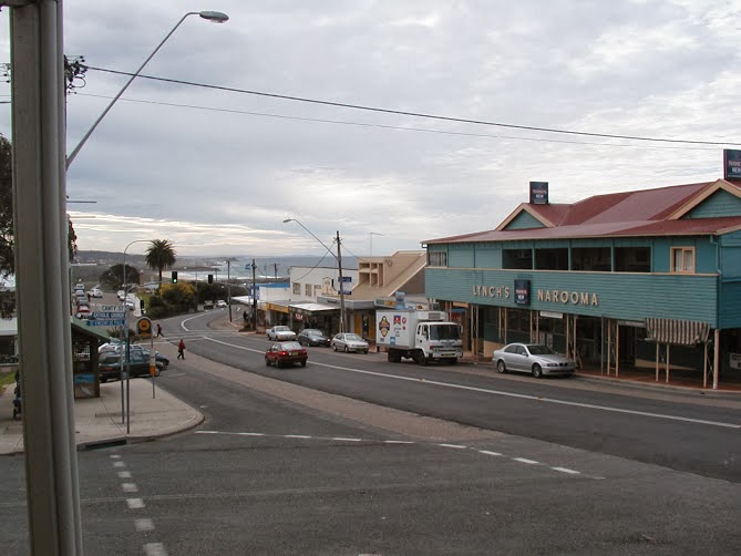
Parramatta is the second settlement in Australia after Sydney in 1788. It is about 14 miles west of central Sydney. The British Colony arrived in the First Fleet at Sydney Cove. They only had enough food for a short time and the soil around Sydney Cove was too poor to grow the amount of food that 1,000 convicts, soldiers and administrators would need to survive. So Governor Arthur Phillip reconnoitred several places before choosing Parramatta as the most likely place for a successful large farm. Parramatta was the furthest navigable point inland on the Parramatta River and also the point at which the river became freshwater and therefore useful for farming.

In November 1788, Governor Phillip with a detachment of marines and a surveyor, made his way upriver to a location that he called The Crescent, a defensible hill curved round a river bend, now in Parramatta Park. As a settlement developed, Governor Phillip gave it the name "Rose Hill" after George Rose, Secretary for the British Treasury. In 1791 he changed the name to Parramatta, approximating the term used by the local Aboriginal people. 

Parramatta Park is a large park adjacent to Parramatta Stadium and a World Heritage Site. It was formerly the Governor's Domain, land set aside for the Governor to supply his farming needs. Originally the grounds were much larger than the today’s Parramatta Park. I usually enter the park by the Queens Road Gatehouse that is just off Park Street and walk clockwise. There is a path that goes round the park (about 2 miles) and also a couple of paths across as seen on the map. There are many historical monuments dotted along the park. There are nice big trees on one side of the path which has lanes for cars and cyclists and pedestrians. While on the inner side there is open grass where on weekend you can see children having football lessons. Further up there is children’s playing area with swings and climbing frames. Most mornings especially in cooler weather, children are brought by mothers and carers, to have a run about and play. 

Just past these is the Domain Creek coming off the Parramatta River. It usually has a few ducks and coots wandering about. The outer side there is the Coleman Oval where fairs are held. Last year there was a medieval fair. There was enacting of some fights; there were some birds of prey and booths selling wood crafts. Sadly it was a wet day and the field was a muddy mire. 

Walking further along there are the Wisteria gardens, only open for a few weeks in spring when the Wisteria and the many cherry trees are in full bloom. This is right at the edge of the river and part of the garden is over the bridge and across the river too. The path moves along the river and the trees on both banks of the river are full of fruit bats. These are a large species of bats and this is a fairly substantial colony. There are also a couple of trees which are home to the Ibis. The river gushes past and you can cross over it via the Button’s Bridge, which carries on as Ross Street Causeway that takes you to the Parramatta Stadium. 

The bridge is a nice spot to see the bat colony. When it is not too warm like on a late winter morning, you can see a few bats taking to air and moving to a new spot. I have never seen bats flying about in  day light so it is always a fascinating experience each time I see them. Once or twice something had disturbed them and large numbers were taking to the air and making that squeaking kind of sound. You can also see the ibises perched on a couple of trees just at the bend of the river. There are some ducks and coots swimming near the banks and also some cormorants. The flowing water is a pleasant sound in the peaceful scene. 


On the left is the dairy cottage and on the right the band rotunda. Dairy Cottage was built from 1798 to 1805, originally a single-room cottage and is one of the earliest surviving cottages in Australia. It was built for ex-convict George Salter. Between 1814 and 1816 it was converted to a dairy.  There is also a café and event centre here. The road curves along the river bank and land rises up. You can also climb down from the car park and walk along the riverbank. There are soaring trees, grasses, ferns and numerous lizards along this small path. 


This joins up with the road when you reach the Crescent.  Across the river next to the Parramatta Stadium and practically the opposite bank of the river is the Old King’s Oval. This used to be race course originally, I seem to have heard. There is a bench just under the trees where one can sit and enjoy the peace and landscape of the Oval. There a particularly some trees that I love looking at.


Moving along on the left is a natural amphitheatre located on one of the bends of the river, named by Governor Philip as "the Crescent", which is used to stage concerts. He built a small house for himself on the hill of The Crescent. In 1799 this was replaced by a larger residence which, substantially improved by Governor Lachlan Macquarie from 1815 to 1818, has survived to the present day, and was used as a retreat by Governors until the 1850s. Governor Brisbane made it his principal home for a short period in the 1820s. The house, Old Government House, is currently a historic site and museum within Parramatta Park and is Australia's oldest surviving public building.
The road along the Crescent is lined with Oak trees. It is strange to have this European tree, which in winter are probably the only trees without leaves, leaving the sunlight to warm walkers on the road. In summer the leaves from good canopies that provide the much needed shade for humans and the fauna. There is a second bridge over the river called the Noller Bridge. This is another place to stand and watch the river. This is also the area for the government farms where wheat, barley, oats and some maize was grown. Moving further along the walk on the left is a pavilion where shows can take place. Once I saw the Elvis Appreciation Society holding a music show there. There is a Tudor Gatehouse, on O'Connell Street, was erected by the Park Trust in 1885 and designed by Gordon McKinnon. It was restored in 1980.
Past the George Street gate house on the left is the bowling green and also Rumsey Rose Garden. The coming of spring starts all the bushes budding. There are so many varieties of roses from all over the world. There are both new and old species to be seen, with so many colours and perfumes. Suring winter the bowling green can hold entertainment events, like a movie being shown on a screen on the side of a large van, a couple of stalls set up to sell tea and sandwiches. People can picnic while watching movies and warming in the winter sun.
Further up the road on to the right of the road is the Boer War Memorial. The pillars and plinth of the memorial are supposed to be from the original post office building. The memorial has 3 cannons, one on either side and a smaller one on top to the plinth. Then one walk right up to the spot where the remains of Governor Brisbane's private astronomical observatory, constructed in 1822, are visible. Astronomers, who worked at the observatory, discovering thousands of new stars and deep sky objects, include James Dunlop and Carl Rümker.


Next is the Bath House designed for Governor Brisbane, in 1822 Colonial Architect S L Harris and built the following year. Water was pumped to the Bath House through lead pipes from the Parramatta River. Then it was pumped out and downhill to a duck pond on the slope below. The Bath House was sophisticated having a heated plunge pool and a domed roof surmounted by a cupola lantern. By 1886 the Bath House had become dilapidated and the Park Trustees converted it into a pavilion which is used as a picnic shelter. On the left side of the road the park boundary ends fairly close as there is a railway line running next to it.

The right side had open grass which used to be cattle paddocks. This was also the place where the first airplane landed in 1911, on 4 November. William Ewart “Billy” Hart, made one of the earliest and longest flights in New South Wales, when he flew a Bristol Box-kite aircraft from Penrith to land at Parramatta Park. In this first cross country flight in New South Wales, Hart astonished the community by travelling a distance of 18 miles (29km) in under 20 minutes, and his aircraft reached an altitude of 3000 feet. This flight was acclaimed as a remarkable performance and Parramatta celebrated his achievement, which was credited with taking Parramatta “a leap into the future”.
Continuing further you complete a full circle back to the Western Domain and the gate house we entered near. There are a variety of eucalyptus such as Tallowoods, Swampy Mahogany, New England Peppermints, Lemon scented Gums, Red Forest Gums, Argyle Apple and Broad Leaf Ironbarks; Jacarandas, Pin Oaks, Stone Pines, Oleanders, Weeping Willows at the end of the river, Kurrajongs, Agathis, Camphor Laurels, Araucarias and various Palms are all growing around the park. Over 120 bird species have been recorded in the park such as fruit bats, parakeets, lorikeets, blackbirds, ravens, pigeons of different species, ducks, cormorants, geese, coots, and so many more that I can barely register before they disappear.


This is the best way of taking exercise, as it provides the physical work out and at the same time relaxes and de-stresses you with the calm environment and gently sounds of the birds, breeze and water flowing.